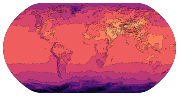
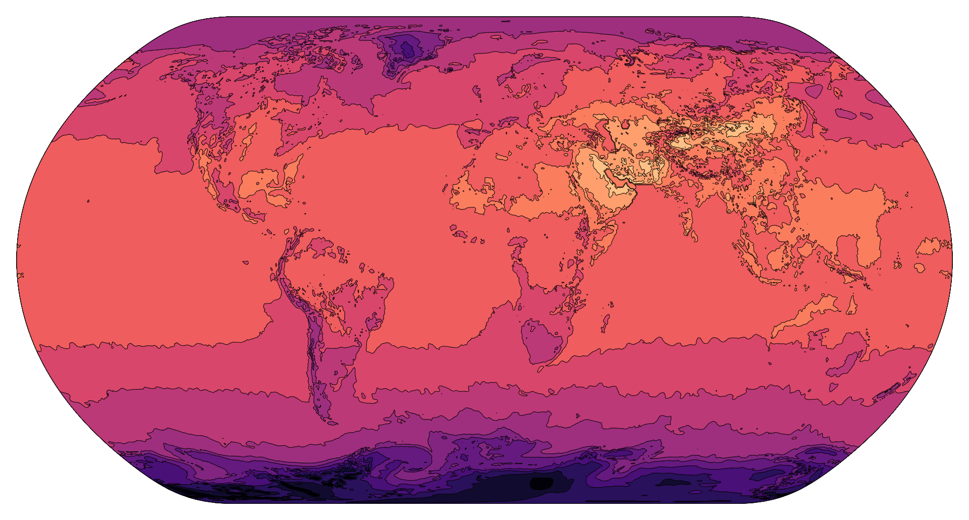
GeoTIFF contours refer to topographic contour lines stored in a GeoTIFF (Geographic Tagged Image File Format) file. These contour lines represent points of equal elevation on a map, helping to visualize the terrain’s shape and steepness. GeoTIFF contours are often used in geographic information systems (GIS) and mapping applications for tasks like land surveying, environmental planning, and infrastructure development. They provide valuable information about elevation changes and geographic features, aiding in spatial analysis and decision-making processes.
Purpose :
The purpose of GeoTIFF contours is to provide a digital representation of elevation data in the form of contour lines within a GeoTIFF raster image. Contour lines depict points of equal elevation on the Earth’s surface and are widely used in various fields for terrain visualization, analysis, and mapping. Here are some specific purposes of GeoTIFF contours:
Terrain Visualization: GeoTIFF contours allow users to visualize the topography of an area by displaying contour lines that connect points of equal elevation. This visualization helps in understanding the shape, slope, and relief of the terrain, which is valuable for cartographic purposes, land management, and outdoor recreation.
Elevation Analysis: GeoTIFF contours enable quantitative analysis of elevation data, such as calculating elevation profiles, slope gradients, and aspect angles. These analyses are used in hydrology, geology, environmental science, and engineering for studying terrain characteristics, assessing terrain suitability, and planning infrastructure projects.
Map Production: GeoTIFF contours are commonly used in map production to create topographic maps, trail maps, and land use maps. Contour lines provide essential geographic information that aids in map interpretation, navigation, and spatial analysis.
3D Visualization: GeoTIFF contours can be used to generate three-dimensional (3D) visualizations of terrain surfaces, allowing users to explore and interact with the landscape from different perspectives. 3D visualization enhances understanding of terrain features and facilitates communication of spatial information.
Precision Agriculture: In agriculture, GeoTIFF contours are used for precision farming applications such as soil analysis, drainage planning, and crop management. Contour maps help farmers identify areas with specific elevation characteristics, optimize irrigation and drainage systems, and plan crop planting and harvesting activities.
Natural Resource Management: GeoTIFF contours support natural resource management efforts by providing information on slope, elevation, and landform distribution. Resource managers use contour data for land use planning, habitat assessment, wildfire risk analysis, and watershed management.
Disaster Management: In disaster management, GeoTIFF contours are used for assessing terrain vulnerability, identifying flood-prone areas, and planning emergency response strategies. Contour maps help emergency responders and planners anticipate the impact of natural hazards and mitigate risks to communities and infrastructure.
Environmental Monitoring: GeoTIFF contours are used in environmental monitoring programs to track changes in terrain elevation over time. Monitoring elevation changes helps in assessing erosion rates, monitoring land subsidence, and studying the effects of climate change on landscape dynamics.
Uses :
Contours stored in GeoTIFF format, often referred to as “GeoTIFF contours,” serve various purposes in geographic analysis, cartography, and terrain visualization. Here are some common uses:
Topographic Mapping: GeoTIFF contours are frequently used in topographic mapping to represent elevation information on maps. They provide lines connecting points of equal elevation, allowing map users to visualize terrain features such as hills, valleys, and ridges.
Terrain Visualization: GeoTIFF contours are utilized in terrain visualization applications to create three-dimensional representations of landscapes. By overlaying contours on digital elevation models (DEMs) or elevation rasters, users can generate realistic terrain models for visualization and analysis purposes.
Engineering and Infrastructure Planning: GeoTIFF contours are valuable for engineering projects and infrastructure planning, where accurate elevation data is essential. Engineers and planners use contours to assess slope gradients, identify suitable locations for construction, and plan infrastructure projects such as roads, railways, and pipelines.
Natural Resource Management: GeoTIFF contours play a role in natural resource management, particularly in forestry, agriculture, and environmental monitoring. They help in assessing terrain characteristics, estimating water runoff, planning land use activities, and managing natural habitats.
Hydrological Analysis: GeoTIFF contours are used in hydrological analysis to delineate watersheds, identify drainage patterns, and model surface water flow. They provide valuable information for assessing flood risks, designing drainage systems, and managing water resources.
Outdoor Recreation and Navigation: GeoTIFF contours are beneficial for outdoor enthusiasts, hikers, and adventure seekers who rely on detailed elevation information for route planning and navigation. Contour maps help users understand the terrain, plan hiking trails, and navigate rugged landscapes safely.
Environmental Impact Assessment: GeoTIFF contours are employed in environmental impact assessments (EIAs) to evaluate the potential impacts of development projects on the natural landscape. They assist in identifying sensitive areas, assessing changes in terrain elevation, and predicting ecological consequences.
Geological Mapping: GeoTIFF contours are used in geological mapping to delineate geological features such as fault lines, rock formations, and geological boundaries. Geologists use contour maps to analyze terrain structure, map geological units, and interpret subsurface geology.
Disaster Management: GeoTIFF contours are utilized in disaster management for risk assessment, emergency planning, and response efforts. They provide essential elevation data for assessing landslide risks, predicting flood inundation areas, and identifying evacuation routes in disaster-prone regions.
Education and Research: GeoTIFF contours are valuable resources for educational purposes and research projects in geography, geology, environmental science, and related disciplines. They provide students, researchers, and educators with access to high-quality elevation data for studying terrain features, conducting spatial analysis, and exploring geographic phenomena.
Reviews
There are no reviews yet.
Only logged in customers who have purchased this product may leave a review.
Reviews
There are no reviews yet.