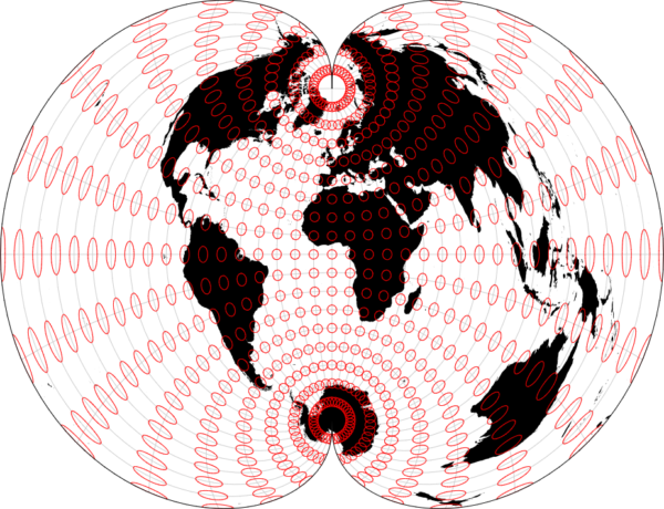
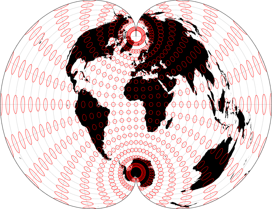
Tissot’s indicatrix is a graphical tool used in cartography to visualize distortions in map projections. It consists of a series of circles of equal size drawn on a map, which represent the distortion of direction and scale caused by the projection method employed. By observing changes in the shape and size of these circles across different regions of the map, cartographers can assess the accuracy and suitability of a particular projection for representing the Earth’s surface.
Purpose :
Assessing Map Projection Distortions: Indicatrices allow cartographers to visualize and quantify the distortions present in different map projections. By comparing the size, shape, and orientation of indicatrix circles before and after projection, cartographers can assess the accuracy and suitability of a particular map projection for specific mapping purposes.
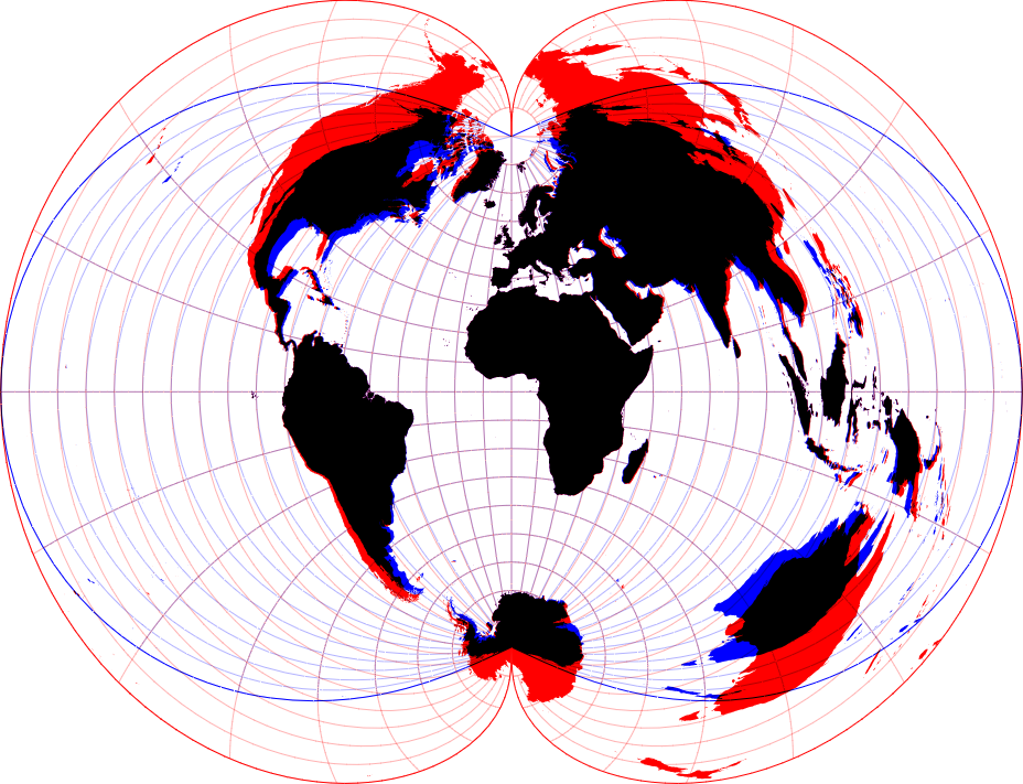
Comparing Map Projections: Indicatrices provide a standardized method for comparing different map projections. Cartographers can use indicatrices to evaluate how different projections handle scale, shape, and direction distortions across different regions of the map.
Selecting Appropriate Map Projections: Indicatrices help cartographers select the most appropriate map projection for their specific mapping needs. By analyzing indicatrix distortions, cartographers can choose projections that minimize distortions in key features such as area, distance, or direction.
Educational Tool: Indicatrices serve as educational tools for teaching students and practitioners about map projection distortions. They help individuals understand the complex relationships between the Earth’s surface and map representations, fostering a deeper appreciation for the challenges of cartographic representation.
Improving Map Design: Indicatrices can inform map design decisions by highlighting areas of significant distortion. Cartographers can use indicatrix analysis to adjust map symbology, labeling, and layout to minimize the visual impact of distortions on map readers.
Communicating Cartographic Concepts: Indicatrices help cartographers communicate cartographic concepts and principles to map users. By visually illustrating the distortions inherent in map projections, indicatrices promote spatial literacy and enhance map interpretation skills among map readers.
Overall, the purpose of Tissot’s indicatrix is to provide a systematic and visual approach to understanding map projection distortions, facilitating informed decision-making in cartographic design and analysis.
Uses :
Assessing Map Projection Distortions: Indicatrices allow cartographers to visualize and quantify the distortions present in different map projections. By comparing the size, shape, and orientation of indicatrix circles before and after projection, cartographers can assess the accuracy and suitability of a particular map projection for specific mapping purposes.
Comparing Map Projections: Indicatrices provide a standardized method for comparing different map projections. Cartographers can use indicatrices to evaluate how different projections handle scale, shape, and direction distortions across different regions of the map.
Selecting Appropriate Map Projections: Indicatrices help cartographers select the most appropriate map projection for their specific mapping needs. By analyzing indicatrix distortions, cartographers can choose projections that minimize distortions in key features such as area, distance, or direction.
Educational Tool: Indicatrices serve as educational tools for teaching students and practitioners about map projection distortions. They help individuals understand the complex relationships between the Earth’s surface and map representations, fostering a deeper appreciation for the challenges of cartographic representation.
Improving Map Design: Indicatrices can inform map design decisions by highlighting areas of significant distortion. Cartographers can use indicatrix analysis to adjust map symbology, labeling, and layout to minimize the visual impact of distortions on map readers.
Communicating Cartographic Concepts: Indicatrices help cartographers communicate cartographic concepts and principles to map users. By visually illustrating the distortions inherent in map projections, indicatrices promote spatial literacy and enhance map interpretation skills among map readers.
Reviews
There are no reviews yet.
Only logged in customers who have purchased this product may leave a review.
Reviews
There are no reviews yet.