Description :
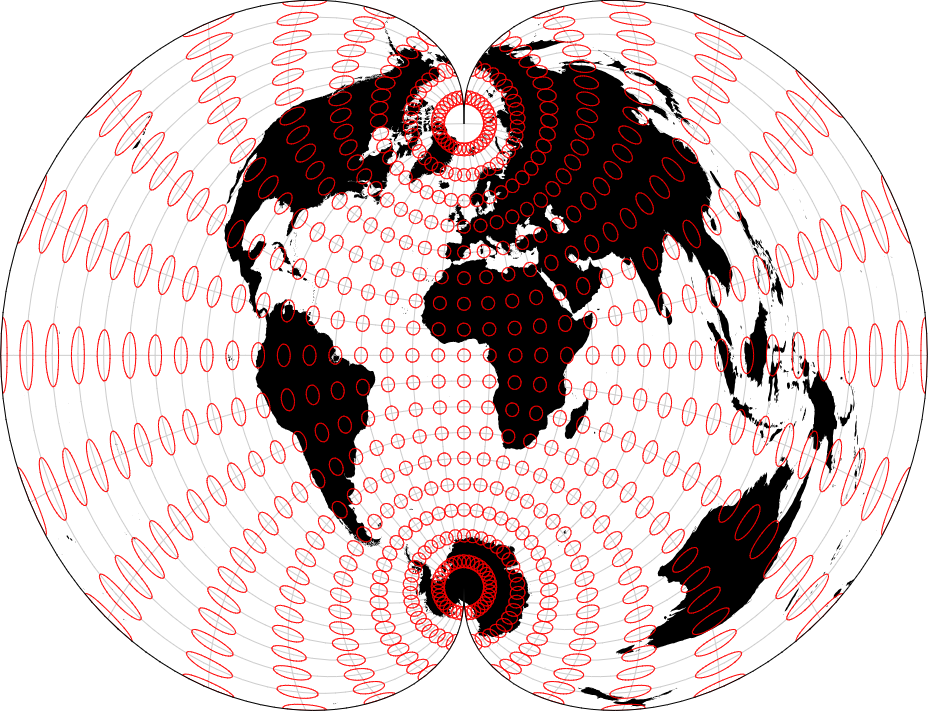
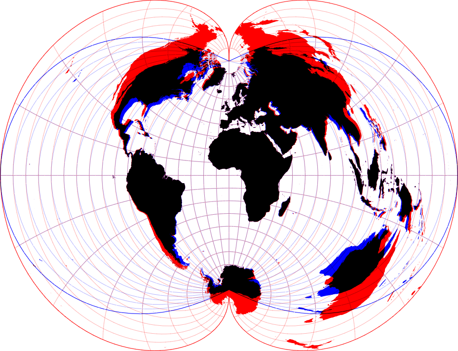
Projection comparison involves evaluating different map projections to understand how they distort the Earth’s surface on a flat map. Cartographers assess properties like shape, area, distance, and direction preservation in each projection to select the most suitable one for specific mapping tasks. By comparing projections side by side, users can identify distortions and trade-offs, ultimately making informed decisions about which projection best represents their geographic data. This process ensures accurate and effective map representation while minimizing distortion.
Purposes :
The purposes of projection comparison involve evaluating and understanding the differences and trade-offs between different map projections. Here are some key purposes:
Visual Representation: Projection comparison allows cartographers and map users to visually assess how different map projections distort the shape, area, distance, or direction of geographic features. This aids in selecting an appropriate projection for specific mapping tasks.
Accuracy Assessment: By comparing various map projections, researchers can assess the accuracy and fidelity of each projection in representing the Earth’s surface. This is particularly important for applications requiring precise measurements or spatial analysis.
Understanding Distortions: Projection comparison helps users understand the distortions inherent in different map projections. It allows them to identify areas where distortions are minimal or most pronounced, aiding in interpretation and analysis of spatial data.
Selecting Suitable Projections: Comparing map projections enables users to select the most suitable projection for their specific mapping needs. Different projections excel in preserving certain properties, such as shape, area, distance, or direction, and projection comparison helps in choosing the one that best fits the purpose of the map.
Educational Tool: Projection comparison serves as an educational tool to teach students and professionals about the concept of map projections and their implications for cartographic representation. It helps learners understand the complexities of representing a three-dimensional Earth on a two-dimensional map surface.
Decision Making: For cartographers, GIS specialists, and decision-makers, projection comparison aids in making informed decisions about which projection to use for a particular mapping project. This ensures that the resulting maps accurately represent the spatial relationships and patterns of interest.
Spatial Analysis: Comparing projections is essential for spatial analysis tasks such as overlaying data layers, measuring distances, and analyzing spatial relationships. Understanding how different projections distort spatial data allows analysts to account for these distortions and make more accurate interpretations.
Standardization and Consistency: Projection comparison helps in establishing standards and guidelines for map production and dissemination. By understanding the strengths and weaknesses of different projections, cartographers can ensure consistency and coherence in map design and usage.
Overall, projection comparison serves as a critical tool for evaluating, selecting, and understanding the implications of different map projections for cartographic representation and spatial analysis. It facilitates informed decision-making and enhances the accuracy and effectiveness of mapping endeavors.
Uses :
Projection comparison serves several practical purposes in the field of cartography and geographic information science. Here are some key uses:
Selecting the Most Appropriate Projection: One of the primary uses of projection comparison is to help cartographers and GIS professionals select the most appropriate projection for their specific mapping needs. By comparing different projections, users can evaluate how each projection distorts properties such as shape, area, distance, and direction, and choose the projection that best preserves the desired properties for their map.
Understanding Distortions: Projection comparison allows users to understand the distortions inherent in different map projections. By visually comparing how features are represented in different projections, users can gain insights into the types and extent of distortions present in each projection. This understanding is crucial for interpreting and analyzing spatial data accurately.
Evaluating Trade-offs: Different map projections have trade-offs in terms of preserving different properties of the Earth’s surface. Projection comparison helps users evaluate these trade-offs and make informed decisions about which properties are most important for their mapping purposes. For example, users may need to prioritize preserving either shape, area, distance, or direction, depending on the specific requirements of their map.
Educational Tool: Projection comparison serves as an educational tool to teach students and professionals about map projections and their implications for cartographic representation. By visually comparing different projections and discussing their characteristics and distortions, users can develop a better understanding of the complexities involved in representing a three-dimensional Earth on a two-dimensional map surface.
Quality Assurance: Projection comparison can be used as a quality assurance tool to ensure the accuracy and reliability of map products. By comparing maps produced using different projections, users can identify any discrepancies or inconsistencies and take corrective measures to improve the accuracy and reliability of their maps.
Spatial Analysis: Projection comparison is essential for spatial analysis tasks such as overlaying data layers, measuring distances, and analyzing spatial relationships. Understanding how different projections distort spatial data allows analysts to account for these distortions and make more accurate interpretations and decisions based on spatial analysis results.
Standardization and Consistency: Projection comparison helps in establishing standards and guidelines for map production and dissemination. By understanding the strengths and weaknesses of different projections, cartographers can ensure consistency and coherence in map design and usage, thereby improving communication and interoperability among different map products.
Overall, projection comparison is a valuable tool for evaluating, selecting, and understanding the implications of different map projections for cartographic representation and spatial analysis. It facilitates informed decision-making and enhances the accuracy and effectiveness of mapping endeavors.
Reviews
There are no reviews yet.
Only logged in customers who have purchased this product may leave a review.


Reviews
There are no reviews yet.